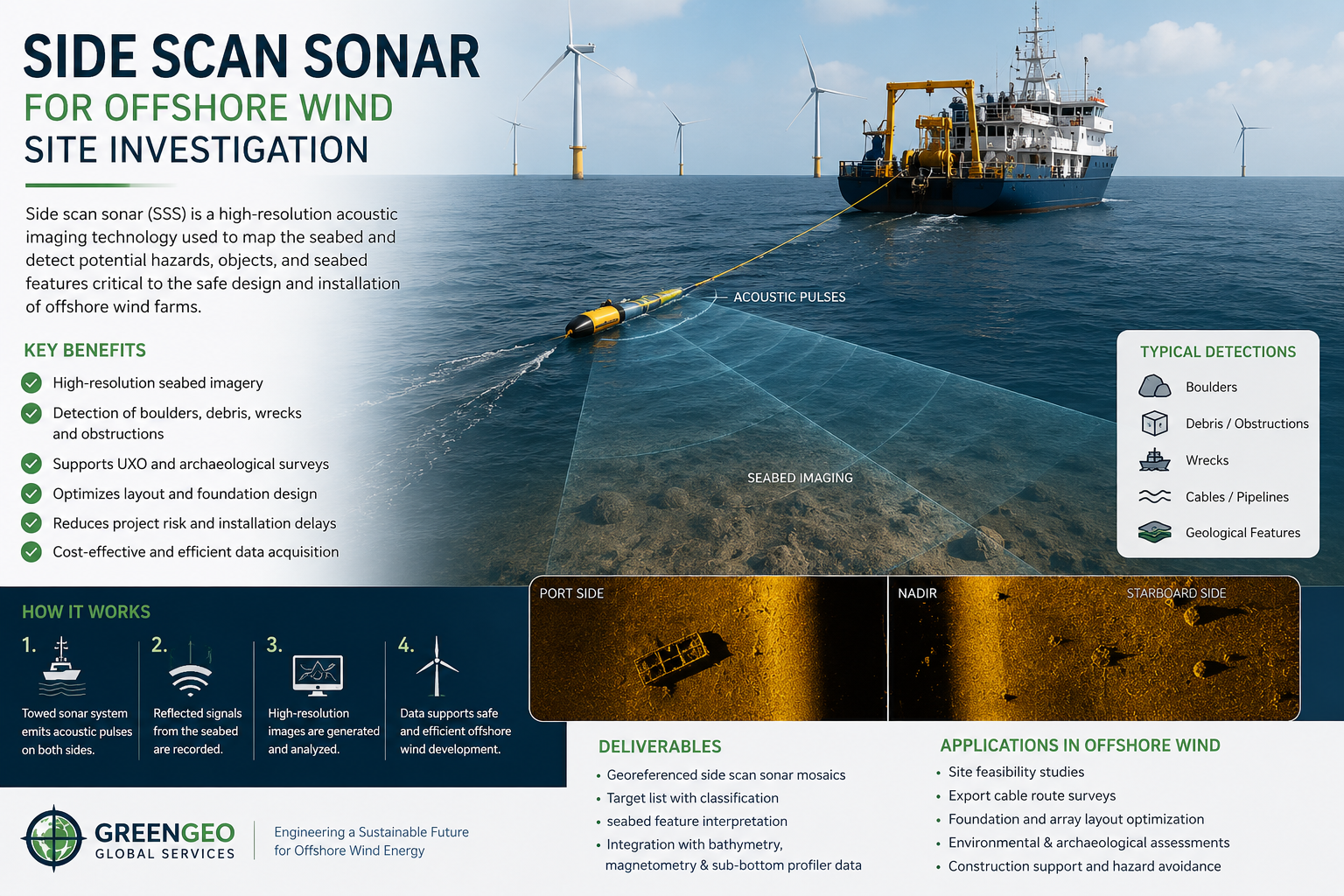
Side scan sonar is one of the most valuable geophysical tools used during offshore wind site investigation surveys. As offshore wind projects move into larger development zones, more complex seabed environments, and tighter construction schedules, developers need reliable seabed intelligence that supports engineering, procurement, installation planning, and risk management. Side scan sonar provides that intelligence by delivering high-resolution acoustic imagery of the seabed surface, helping project teams identify hazards, characterize seabed conditions, and improve confidence in technical decisions.
For offshore wind developments, side scan sonar is not simply a visualization tool. When acquisition, processing, interpretation, and quality control are performed to a high standard, the dataset becomes a practical decision-support resource. It can influence cable routing, foundation positioning, target selection for intrusive investigation, construction methodology, and the prioritization of mitigation measures. In a sector where vessel time is expensive and design uncertainty can create major downstream costs, the quality of side scan sonar data has direct commercial relevance. For a broader view of how expert advisory input improves offshore survey programs, see our insight on building better survey outcomes with expert consultants.
Why side scan sonar matters
Offshore wind site investigation requires a detailed understanding of seabed conditions across turbine array areas, export cable corridors, landfall approaches, and offshore substation locations. Bathymetry and sub-bottom profiling provide critical information, but they do not replace the need for detailed seabed surface imaging. Side scan sonar fills that gap by transmitting acoustic pulses laterally and recording the strength of the seabed backscatter response. The resulting imagery can reveal debris, boulders, bedforms, exposed rock, trawl marks, scour features, sediment boundaries, and other seabed anomalies that may affect engineering design or installation execution.
This level of detail is especially important in offshore wind because many project risks are controlled by near-surface seabed conditions. Boulder fields may constrain foundation installation. Debris may create hazards for cable burial tools or jack-up operations. Mobile sand waves can affect long-term cable stability. Localized scour may indicate active hydrodynamic processes that require further engineering assessment. Side scan sonar helps convert general seabed understanding into site-specific technical evidence that project teams can use with confidence. It also complements shallow subsurface methods such as UHRS seismic surveys for offshore wind site investigation, which help teams understand conditions below the seabed surface.
Key survey drivers
- Hazard identification across turbine and cable areas
- Improved seabed characterization for engineering teams
- Target selection for follow-up geotechnical investigation
- Support for route optimization and constructability review
Project outcomes
- Reduced uncertainty before detailed design
- Better planning for installation spreads and vessel operations
- More robust anomaly registers and risk assessments
- Stronger technical basis for client decisions
Typical applications in offshore wind surveys
During offshore wind site investigation, side scan sonar is commonly used to identify anthropogenic debris, wreck-related material, boulder distributions, exposed rock, and seabed mobility features. It also supports the mapping of sediment texture changes and the inspection of existing subsea infrastructure or crossings. Along export and inter-array cable routes, the data can help highlight seabed conditions that may influence burial performance, trenching strategy, or the need for route refinement.
These applications are particularly valuable during early development and pre-construction phases, when project teams are narrowing layouts, refining survey scopes, and assessing constructability constraints. High-quality side scan sonar interpretation can reduce the number of unknowns carried into detailed engineering and procurement packages, improving schedule predictability and reducing the risk of late-stage redesign.
In offshore wind, side scan sonar is most valuable when it is treated as an engineering decision tool rather than a simple imaging product.
Acquisition quality is critical
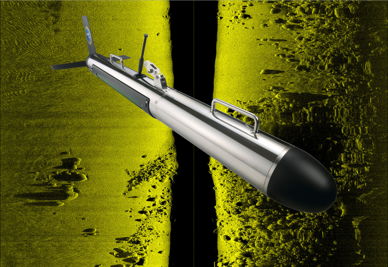
The usefulness of side scan sonar data depends heavily on acquisition quality. Survey design must consider line spacing, sonar frequency, range settings, towfish altitude, vessel speed, navigation accuracy, and the expected seabed environment. These parameters need to be aligned with project objectives and target detection requirements. A dataset that looks visually acceptable may still be inadequate if coverage gaps, poor overlap, unstable towfish altitude, or positional uncertainty reduce its reliability for engineering use.
Higher frequencies generally provide better resolution but reduced range, while lower frequencies increase coverage at the expense of detail. Towfish altitude must be controlled to minimize nadir width and acoustic distortion. Navigation and layback estimation must be robust, because poor target positioning can undermine the value of anomaly identification when the data is later used for design, ROV verification, or intrusive follow-up investigation. Environmental conditions such as sea state, towing instability, and acoustic noise can also degrade data quality and should be monitored continuously during acquisition.
Processing and interpretation
Raw side scan sonar records do not automatically provide project-ready information. Processing is required to correct slant range, balance gain, suppress noise, improve contrast, and prepare the data for mosaicking and interpretation. Interpretation then requires experienced geophysicists who understand both acoustic response behavior and the engineering context of offshore wind development. Bright reflectors, acoustic shadows, and textural changes may indicate very different seabed conditions depending on the local geology, survey geometry, and supporting datasets.
The most reliable interpretations are produced when side scan sonar is integrated with multibeam bathymetry, sub-bottom profiler data, magnetometer results, and available geotechnical information. This integrated approach reduces the risk of over-interpreting isolated acoustic signatures and helps clients build a more coherent seabed model. For offshore wind developers, that matters because engineering decisions rarely depend on one dataset alone. They depend on how multiple datasets combine to explain what is present, where it occurs, and what practical consequences it may have for design and construction.
How quality control supports client decisions
Quality control is one of the most important elements of side scan sonar delivery. Clients do not only need data coverage. They need confidence that the data is technically reliable, complete, and suitable for the decisions they must make. Effective quality control verifies that acquisition parameters were appropriate, coverage objectives were achieved, positioning is defensible, processing steps were applied correctly, and interpreted anomalies are traceable back to the source data. Without that discipline, even large survey datasets can create false confidence.
From a project perspective, quality-controlled side scan sonar data improves decision-making in several ways. It supports more reliable hazard registers by confirming whether anomalies are genuine and spatially constrained. It helps prioritize follow-up actions such as ROV inspection, diver verification, route adjustment, or geotechnical targeting. It reduces the likelihood of late-stage surprises during installation, when unidentified debris, boulders, or seabed variability can trigger vessel downtime, redesign, or contractor claims. It also improves communication between survey contractors, designers, developers, and investors by ensuring that technical findings are reported clearly and consistently.
Quality control checks
- Range performance and nadir behavior
- Line overlap and coverage completeness
- Navigation consistency and target positioning
- Mosaic continuity and processing logic
- Interpretation traceability and anomaly classification
Client benefits
- Better engineering confidence
- Improved contractor oversight
- Reduced installation risk
- Stronger basis for investment and approval decisions
- Clearer prioritization of follow-up work
How GreenGeo Global Services adds value
GreenGeo Global Services supports offshore wind developers, marine contractors, investors, and asset owners by providing technically rigorous review of marine site investigation data and survey deliverables. In side scan sonar projects, our role can include specification support, acquisition oversight, data quality review, interpretation validation, anomaly assessment, and integration of geophysical findings into broader engineering decision frameworks.
Our multidisciplinary perspective is valuable because offshore wind site investigation is not only a geophysical exercise. Survey outputs must ultimately support engineering design, installation planning, risk management, and commercial decision-making. GreenGeo helps bridge that gap by translating technical survey observations into practical project implications. We help clients understand what the data means, where uncertainty remains, and which actions are justified before moving into subsequent project phases. Readers interested in the wider renewable context can also explore Spain’s solar energy market to see how technical assurance supports project value across different energy sectors.
Conclusion
As offshore wind projects increase in scale and complexity, the importance of high-quality seabed characterization continues to grow. Side scan sonar remains a core component of that effort because it provides the detailed seabed imagery needed to identify hazards, understand surface conditions, and support efficient engineering decisions. Its true value, however, is realized only when the data is acquired correctly, interpreted by experienced specialists, and subjected to disciplined quality control.
For clients, quality-controlled side scan sonar data is more than a survey deliverable. It is a decision-support tool that can reduce uncertainty, improve design confidence, and help avoid costly downstream issues during installation and operation. GreenGeo Global Services helps clients extract that value through independent technical review, practical engineering insight, and a quality-focused approach to offshore wind site investigation.